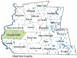
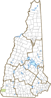
History of Chesterfield
Incorporated: 1752.
Origin: Established in 1735 while New Hampshire was still under governance of Massachusetts, this town was the site of Fort Number 1 in the line of protective trading forts bordering the Connecticut River. After New Hampshire became an independent province under Governor Benning Wentworth, the town was incorporated in 1752 as Chesterfield, after Philip Stanhope, fourth Earl of Chesterfield. The Earl served as Secretary of State and joined William Pitt in opposing what they considered England’s unfair treatment of the American Colonies. Chesterfield was the birthplace of Harlan Fiske Stone, Chief Justice of the Supreme Court from 1941 to 1946.
Villages and Place Names: Spofford, West Chesterfield.
Population, Year of the First Census Taken: 1,905 residents in 1790.
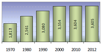
Population Trends: Population change for Chesterfield totaled 2,200 over 52 years, from 1,405 in 1960 to 3,605 in 2012. The largest decennial percent change was 41 percent between 1970 and 1980. The 2012 Census estimate for Chesterfield was 3,605 residents, which ranked 103rd among New Hampshire’s incorporated cities and towns.
Population Density and Land Area, 2010 (US Census Bureau): 79.1 persons per square mile of land area. Chesterfield contains 45.6 square miles of land area and 2.0 square miles of inland water area.